Airborne Geophysics

Large-Scale Drone Surveys

Drone-Based Vector Magnetic Surveys

  • Deploy Fixed-Wing Swarms
  • Capture High Resolution Data
  • Measure XYZ Magnetic Vectors

Structural Interpretation of Magnetic Data

  • Map Complex Structures
  • Define Drill Targets
  • Reveal Geological History

3D Inversion of Magnetic Data

  • 3D Subsurface Models
  • Reduce Model Ambiguity
  • Isolate Remanent Magnetization

Drone-Based Electromagnetic Surveys

  • Profile subsurface conductivity
  • Deploy low-noise B-field receivers
  • Resolve targets up to 300m

Electromagnetic Inversion Services

  • Perform 1D and 3D inversions
  • Model subsurface resistivity
  • Correct for magnetic susceptibility

SASKATCHEWAN

MANITOBA

ONTARIO

NEWFOUNDLAND

NVT & NWT

geophysical surveying service area map

Smarter Exploration

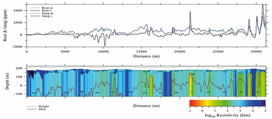
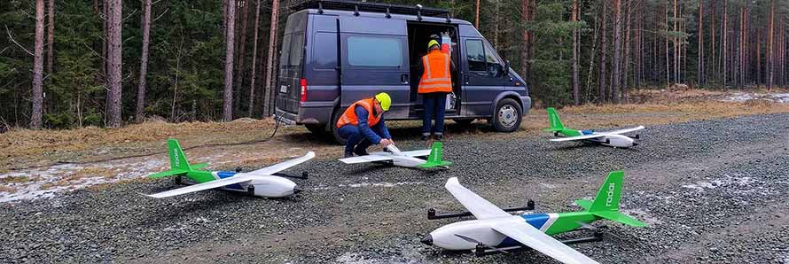
Speed up early exploration with fixed-wing drone swarms.

Faster

Cover up to 1,500 line km / day

Safer

Send drones to do the dirty work

Cheaper

Without sacrificing data quality

CONTACT

info@radai.ca