Vector Magnetic Surveys

Drone-Based Vector Magnetics

The Radai Advantage

At Radai, we specialize in high-resolution, low-altitude aeromagnetic surveys designed for the demanding environments of modern mineral exploration.

By utilizing advanced VTOL (Vertical Take-Off and Landing) fixed-wing drones, we combine the efficiency and range of traditional fixed-wing aircraft with the precision of a helicopter. Our proprietary multipurpose RMP dataloggers and integrated 3-component fluxgate magnetometers deliver clean, reliable data that geophysicists trust.

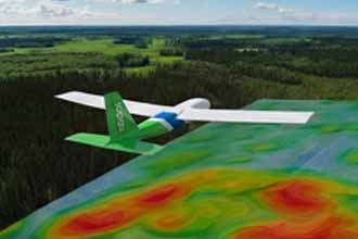
Fixed-Wing Drone Swarms

Our surveys are conducted using state-of-the-art VTOL drones. This allows us to launch from tight clearings in remote locations without the need for an airstrip. Combined with BVLOS (Beyond Visual Line of Sight) capabilities, we deploy multiple aircraft simultaneously to survey up to 1,500 line-kilometers per day.

Terrain Following

An advanced autopilot guides the drone through GPS waypoints, strictly following high-resolution Digital Elevation Models.
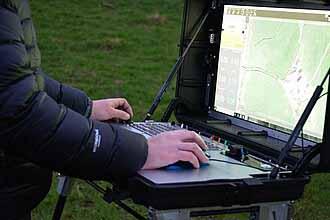
BVLOS Operations

Long range Beyond Visual Line of Sight (BVLOS) operations allow us to survey massive claim blocks efficiently.

Precision Navigation

GNSS systems and an Inertial Measurement Unit precisely record the drone's position, time, roll, pitch, and yaw.

The Mag Sensor

3-Axis Fluxgate Mag | 130 Hz | Resolution 0.1 nT | Dynamic Range ±100 μT

While many drone surveys only record Total Magnetic Intensity (TMI), Radai measures the vector magnetic field.

Our system utilizes a digital 3-component fluxgate magnetometer housed securely in the tail boom of the aircraft. In addition to the three orthogonal components (XYZ) of the magnetic field, our dataloggers continuously record temperature and barometric pressure to ensure highly accurate flight altitudes.

Why Vector Data Matters

Measuring the individual X, Y, and Z components of the magnetic field provides a significant advantage over standard TMI surveys.

Reduced Ambiguity

Vector data significantly improves 3D data interpretation and inversion modeling.

Remanent Magnetization

XYZ data is crucial to identify and isolate remanent magnetization in complex geology.

Advanced Processing

In-house data processing uses Equivalent Layer Modelling (ELM) to maximize dataset value.

Data Quality & Processing

Rigorous quality control from the field to the final grid.

Base Station Diurnal Corrections

A magnetic base station is deployed near the ground control station to measure temporal variations in the magnetic field. We utilize high-precision Overhauser or Proton Precession magnetometers with a 1 to 3 Hz sampling rate. The airborne data is rigorously corrected against this base station data.

Rapid Field QA/QC

After landing, data is immediately transferred via WLAN to a local PC and uploaded to a secure cloud server. This allows our processing team to perform remote pre-processing and quality control checks while the crew is still mobilized.

Deliverables

We provide clean, leveled data in industry-standard formats (Geosoft .gdb, .xyz, and gridded formats) ready for immediate structural interpretation or 3D inversion.

Structural Interpretation of Magnetic Data

  • Map Complex Structures
  • Define Drill Targets
  • Reveal Geological History

3D Inversion of Magnetic Data

  • 3D Subsurface Models
  • Reduce Model Ambiguity
  • Isolate Remanent Magnetization

Ready to map your targets?

Whether you are exploring for base metals in the Golden Triangle or outlining structural targets in the Abitibi, Radai provides the magnetic resolution you need to drill with confidence.

CONTACT

info@radai.ca